
Drone is airborne and taking photos
The first test flight of the new drone! It didn’t crash.
I bought a drone for photos of garden plans. Originally I thought a drone would only be useful for large gardens but I really think it’ll be an invaluable way of documenting planting plans.
Because any garden with a curve (which in my book should be every garden) is actually quite hard to represent in a CAD planting plan. This is my CAD plan for the Clifftop Garden:
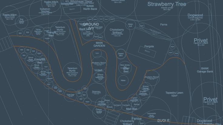
Clifftop Garden in CAD
And this is how it worked out, with photos stitched together:

Stitching photos of gardens together takes a lot of time!
Quite a big difference in dimensions and proportions. I think.
With a drone, I can take a photo of the land before, and use that as the basis for the CAD plan. And then take a photo of the garden once it’s planted up, and use that as the basis for the final planting plan for the client. I’m even toying with putting a version online, using something like CryptPad, so that the client can edit the plan.
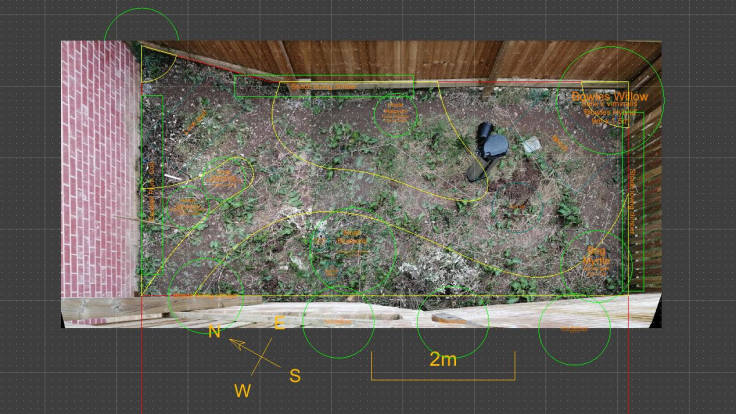
Here’s the small Max Garden, showing the photo montage used as the basis for the planting plan:
Not every garden is small enough with steps to take overhead photos