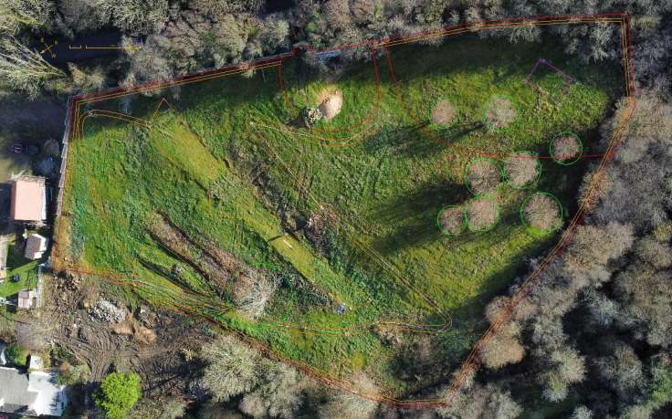
There is distortion but the aerial photo is also very useful
I bought a cheap drone for making garden plans, now I need to figure out how to create an orthomosaic map!
I bought a DJI Mini 2 SE drone to take photos of gardens, so that I can more easily create garden designs and planting plans.
The Tir Garden project is the drone’s first big outing, and I really noticed the distortion from the point-of-view and the lens, when compared to the satellite photo. I kind of expected this but it is marked.
The way round it is to create an orthomosaic map: lots of photos stitched together. This droneblog post discusses Can the DJI Mini 2 Be Used for Mapping?. There is open source software to create such a map, called WebODM and here are the Linux installation instructions.
To take the photos on a pre-planned route, there is Android/iOS software called Litchi.